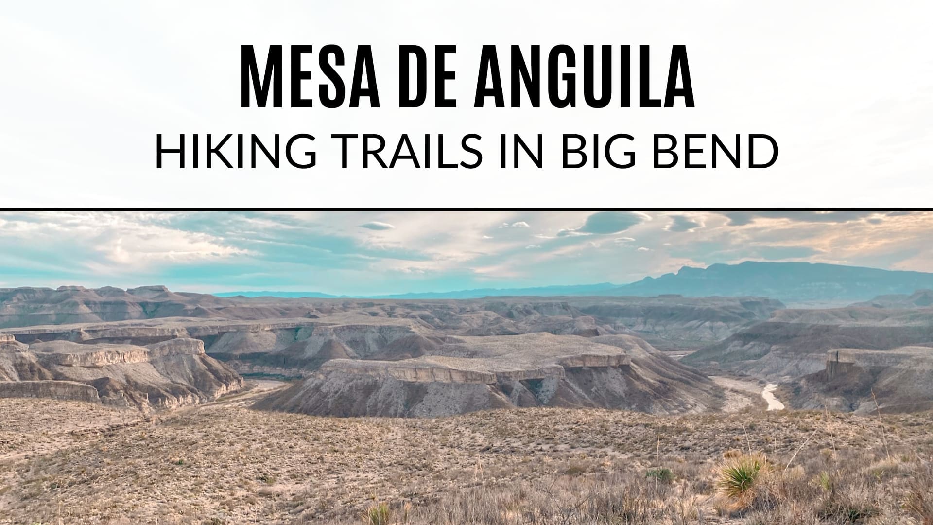
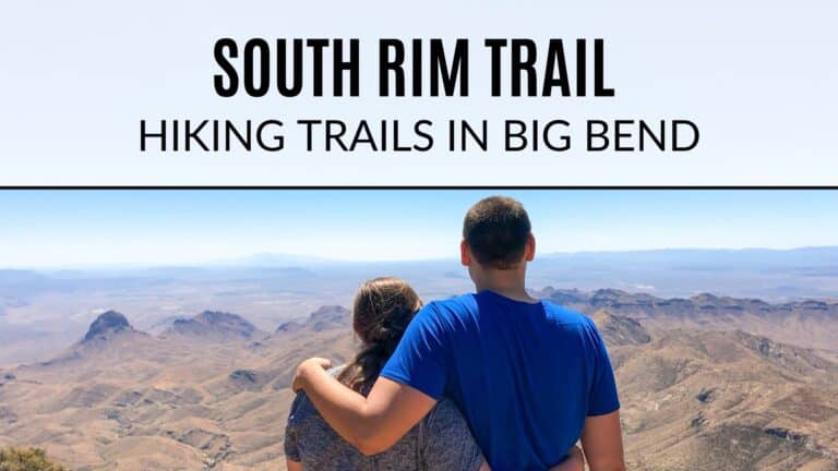
Mesa de Anguila – Hiking Trails in Big Bend National Park
While Big Bend National park is extremely remote, there are definitely certain trails that receive more traffic than others (Lost Mine and Santa Elena are quite popular). If you’re looking for something truly remote and isolated from the rest of the park, you may consider hiking the Mesa de Anguila trail. This Big Bend hike came highly recommended to us from a local we met at church – it didn’t disappoint! In fact, we had the whole thing to ourselves and saw not a single person the entire time.
Table of Contents

Mesa de Anguila is actually not accessed by going through one of the national park entrances. Rather, it’s 21 miles west of Big Bend’s west entrance in Lajitas. While it’s still part of the national park, it’s not a trail that’s really advertised in Big Bend brochures and pamphlets. The mesa is actually one of the least visited areas in the park, making it a perfect place to escape the crowds.
If you plan to stay at Maverick Ranch RV Park or Lajitas Golf Resort, I highly recommend checking out this trail! It’s only a 2 minute or so drive from the RV park to the trailhead and even a short section of the trail cuts through Black Jack’s Crossing Golf Course.
Getting to the Mesa de Anguila Trailhead
As mentioned above, this is a short drive if you’re staying in Lajitas or about 15-20 miles if you’re staying in Terlingua. You’ll turn onto Comanche Mesa from 170 and follow the road past what looks like employee housing. You’ll come to a big dirt lot with some signage in the middle. This is where you’ll want to park. You should be able to see some of the golf course in the distance and the is a sign pointing you to the start of the trail.


Hiking Mesa de Anguila
We only ended up hiking a portion of what is actually a 28 mile long trail (some of which is actually off trail hiking). Mesa de Anguila outlines the westernmost edge of Big Bend. The mesa follows the Rio Grande, and its southern section drops to form the United States side of the Santa Elena Canyon. Backpacking this seldom traveled trail is recommended only for experienced desert backpackers according to the NPS. A permit is required for overnight camping.

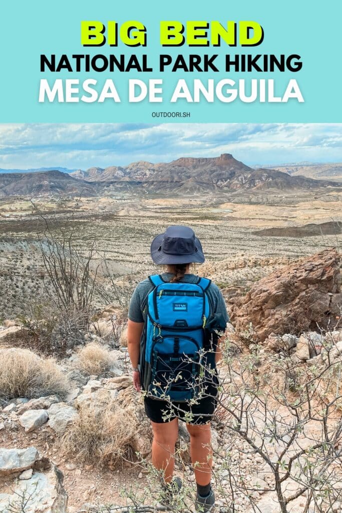
In total, we hiked roughly 4 miles with a 655 foot elevation gain to the saddle of the mesa. You could definitely turn this into a longer day hike if you wish. The first mile is flat with full exposure to the sun so remember your hat, sunscreen and water! There are a few areas that it’s difficult to tell where the trail is. If you keep an eye out for the rock cairns and follow those you should be good. As you reach the base of the mesa, about 1 mile in, that’s when things start to get steep.

The trail narrows out and becomes more rocky. There can be some loose rock in the steeper sections so just take your time and watch your footing. Although this section of the trail maybe a little more challenging, the nice thing is that it is completely shaded.

Once you finish the climb and reach the top, you’ll be rewarded with beautiful views of the Rio Grande and Mexico! If you want to continue on for a longer hike, the trail continues to the right. We were content and enjoyed hanging out with these views for awhile.

Mesa de Anguila is an out and back trail, so when you’re ready to return you’ll follow the same path back to the parking lot. On the way down, you’ll get some pretty incredible views of Lajitas Mesa. We were even able to see Maverick Ranch RV all the way from where we were!

I hope this inspires you to take a trail less traveled, you never know what you might find!
More Hiking Trails in Big Bend National Park
- Guide to Hiking the South Rim
- Hiking Lost Mine Trail
- Hiking Santa Elena Canyon
- Hiking to Balanced Rock
Happy Hiking!
Make sure to pin this post to help plan your trip to Big Bend! For a complete guide to Big Bend National Park, read this post next.


Those views are incredible!!! WOW!
They were amazing!! I was so glad we ended up doing this one.
Love the pictures that you have from this hike!!!! Looks AMAZING!!!
The pictures of the views are AMAZING! It makes me want to go on this hike! I hope we get out here!!
I really hope you get the chance to visit! All the hikes here are pretty incredible ☺️
These views are just incredible! I am so sad we haven’t made it to Big Bend yet, but can’t wait to get out there. Especially with all the awesome tips and trails you’re sharing.
It’s definitely one of those parks that are trickier to make it to just because it’s out in the middle of nowhere 😂 so worth the trip though!!
I can’t wait to get on the road so we can explore places like these! I really appreciate just how thorough you are! I feel like I can’t go wrong visiting Big Bend now. Thanks Megan!
Thank you!! It can be an overwhelming park to try to navigate if you’re not familiar with it. Hope it makes things a bit easier 😁
I seriously cannot wait to make it out that way – your posts are killing me! Thank you for such detailed info!
I feel like I cannot go wrong when I finally visit Big Bend! Thank you so much for providing this detailed info on the different trails and camping options. This hike looks like a great option for those wide-open desert views, and I love that it’s off the beaten path!
These views are amazing! It looks like y’all had the whole park to yourselves. I love this Big Bend series! Can’t wait to visit one day.
I would LOVE to go here!!! The views!!!!
Spent 5 nights out on the Mesa back in the day. This is sacred ground for me. Best friend fell from one of the cliffs up there in ’95. He worked at the park and had discovered the career he wanted to pursue; Park Ranger. He was 25 years old. They memoralized him by naming a natural spring after him – Winterowd Spring.
Ask someone at Panther Junction before heading up to the Mesa and go visit. RIP Jeff
I went with 2 friends to Mesa to hike the 28 miles. My pack was heavier than I thought it would be. Just the mile from parking to the saddle was tough. They ran up the steep incline like Billy goats. I had to stop atleast 10 times. At the top the view was amazing. From there we hiked another 5 miles to Santa Elena Canyon. My hip began to hurt. We were about a mile from Mariposa. A large rock formation. We camped for the night. The next morning I my hip wasn’t having it so I told them to go on without me. I couldn’t even hike back to the car so I stayed on the mesa all day and camped the night alone. Longest, scariest night of my life. Peeing while rotating 360° with a pen flashlight waiting for a bear, wild cat, cartel trafficker, or serial killer to attack me. Truly in the middle of nowhere alone. When daylight cracked I didn’t even take the time to fold my tent or pack properly. I high tailed it back. The view coming back down the saddle was heaven, so was the cheeseburger I went straight for in a Telingua cafe! Stayed at Los Chisos mining Co. Hotel. Checked out La Kiva for dinner. I recommend it. The next morning I went back to Lajitas to pick them up. Can’t believe they hiked 28 miles so easily. They def downplayed the difficulty when convincing me to come. It’s no joke. An extremely advanced hike. Bring water purifiers!