Hiking the South Rim Trail Big Bend
Looking for the best hikes Big Bend National Park has to offer? Look no further than the South Rim Trail! It’s grueling, inspiring, and breath-taking all at the same time. This hike sort of straddles the border between day hike and backpacking trail at 12.6 miles. In fact, there are several backcountry campsites along the trail if you wished to make it an overnight trip. If you decide to tackle this hike in one day like we did, you’ll want to get as early a start as possible. We got started around 9 am and made it back to the parking lot around 6 / 6:30.
Table of Contents
Directions to the South Rim Big Bend Parking and Trailhead
To get to the South Rim Trail parking and trailhead you’ll take Gano Springs Road (which is a continuation of Route 12 west of Panther Junction) to Basin Junction Road. You’ll follow Basin Junction Road all the way to the Visitor Center and Lodge.
There’s a decent amount of parking spaces here (way more than the Lost Mine Trail has). It’s still best to arrive early to ensure you get a parking space.
From the parking lot you’ll follow a sidewalk to the trailhead. Several trails begin in this area (Window, Window view, Laguna Meadow) so you’ll follow the markers with these names on them. When you reach the Chisos Basin Trailhead, the path will split off into two. The trail to the left is Laguna Meadow and that’s where you’ll begin your hike.
Big Bend South Rim Hiking Routes
The South Rim Trail is done in a loop and combines several trails to make it a loop. You can either go clockwise starting with the Pinnacles trail. Going this direction will be a shorter but much steeper climb. Or you can start counterclockwise with the Laguna Meadows trail like we did for a slower more gradual climb up to the South Rim.

Whichever way you choose to hike the trail, you have the option to add on Emory Peak, which is the tallest peak in Big Bend National Park. Choosing to add on Emory Peak will add about another 3 miles to your hike. If you plan to hike clockwise you’ll come to the Emory Peak spur trail from the Pinnacles trail and before you reach Boot Canyon. If you do it counter clockwise, Emory Peak will be towards the end of your trek before you descend down the Pinnacles trail.
The trail name will change several times throughout the the hike and there are several routes you can take. Since this can get confusing, I’ve provided a color coded map below to help make it easier to understand which section I’m talking about. We chose to hike the trail counter clockwise starting with the Laguna Meadows Trail. To make this easy to follow I’ll detail the route we took (just know you can do this in the reverse order that we did).
To summarize, the route we took was: Laguna Meadows > Colima > South Rim > Boot Canyon > Pinnacles> Laguna Meadows

Hiking the South Rim Big Bend National Park
As mentioned above we started with the Laguna Meadow trail. Much of this section of the hike you’ll be in and out of the forest. If you’re starting early in the morning make sure to bring a jacket as much of this first portion will be shaded. You’ll also want to bring more water and food than you’ll think you will need. Laguna Meadow is a fairly flat trail that gradually gains elevation as you approach the South Rim. The trail will change names a few times, but at this point as long as you’re following signs for South Rim you should be good.
As the Laguna Meadow trail ends, you’ll continue on the Colima Trail for a short distance. Up until this point the hike is pretty but is mostly in the forest with not much of a view.
As you approach the South Rim, you’ll get peaks of the mountains here and there. It’s not until you fully reach the South Rim that you’ll get those view payouts you’ve been working for.

Don’t miss the best views of the day!
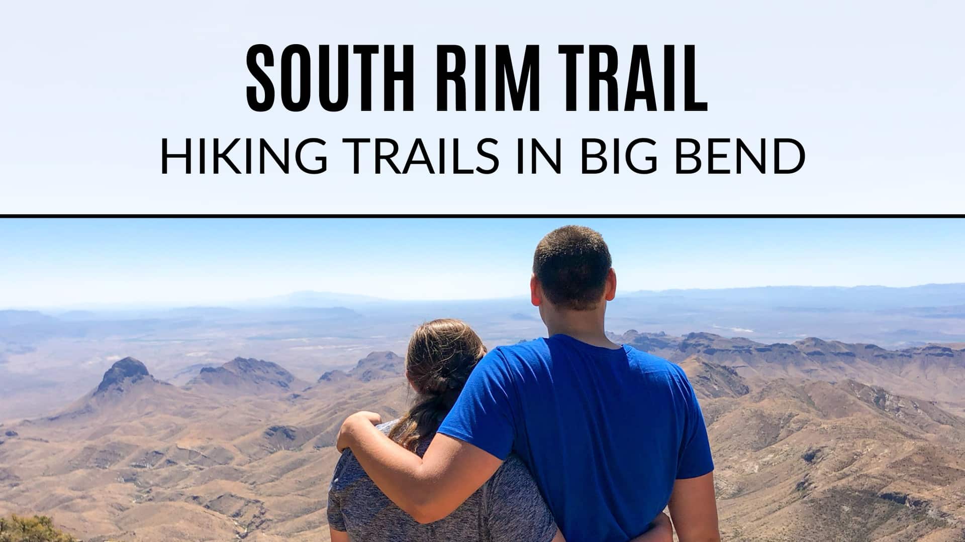
It’s easy to overlook, in fact we almost missed it! From the South Rim Trail there’s a spur trail that goes off to the right. These are hands down some of the best views in the park! This viewpoint area is the perfect spot to stop and get some photos, relax and maybe grab a bite to eat. On a clear day, if you look closely, you may be able to see Santa Elena Canyon in the distance from over 20 miles away!

As you continue your hike along the South Rim, you’ll come to another fork in the trail. Here you can either take Boot Canyon or the Northeast Rim Trail. The Northeast Rim trail is closed during certain seasons for peregrine falcon nesting season, so check ahead to see if it’ll be open during your visit. Taking the Northeast Rim will give you similar views to the South Rim but will be a longer route than Boot Canyon.
The Northeast Rim was closed when we visited in March, so Boot Canyon it is. For the most part Boot Canyon is pretty much a downhill walk until you reach the Pinnacles and Emory Peak trails.

Add on Emory Peak to your South Rim hike
At this point you’ll need to decide whether you’d like to tackle the tallest peak in Big Bend by adding on an additional 3 miles and 800 feet in elevation gain. If you choose to hike to the peak, you’ll be rewarded with 360 degree views after a 25 foot rock scramble up to the top.
We chose not to hike Emory Peak this time. It was already pretty late in the day, we were exhausted and had blisters on our feet. We also wanted to make it back to the parking lot before sundown so we opted to skip it. I really wish we would have done it, but by the time we got back to the campground we were wiped out so it was a good call.
Finish out the hike with the Pinnacles Trail
Boot Canyon turns into the Pinnacles Trail and you’ll begin your descent back down to the Chisos Basin. The trail is quite steep in sections and has what felt like a never ending set of switch backs. I really just wanted to be magically transported back to the car at this point! Eventually, Pinnacles will connect back up with Laguna Meadows (the first trail we started on) and you’ll make your way back to the visitors center where you initially started the hike.

The blisters, sunburn, and sore muscles were totally worth it! In total, I think we ended up doing just over 14 miles. The next day we did a little kayaking and headed to the hot spring to relax and rest.
Happy hiking!
Looking for more Big Bend Hikes?
- Lost Mine (Chisos Basin)
- Balanced Rock (Grapevine Hills Trail)
- The Window & Window View Trail (Chisos Basin)
- Santa Elena Canyon Trail
- Chimneys Trail


Wow! That is one heck of a hike – and those sweeping views are magnificent. I would definitely have to make this an overnighter. Major props for tackling this as a day hike!
It was definitely a challenge! Would love to do an over night trip and add on the peak next time.
I would’ve never known all this was here. And to do all this in one day 🙌🏼 We have realized we go at a slower pace on big hikes 🤣 now Kallie, she’d run through the whole place if we let her, sometimes she’s pulling us up like “come on you guys!!”
Oh yeah we definitely had to stop for lots of water / snack breaks. We were exhausted by the end 😂
We missed out on this hike when we visited Big Bend! We will definitely have to make sure we hit it next time!
It is such a good one! I’d definitely like to break it up next time and camp up there 😆
Wow! That’s quite the hike! Y’all are rock stars and the views look incredible
You done it again, Megan!! Another place I HAVE to visit!