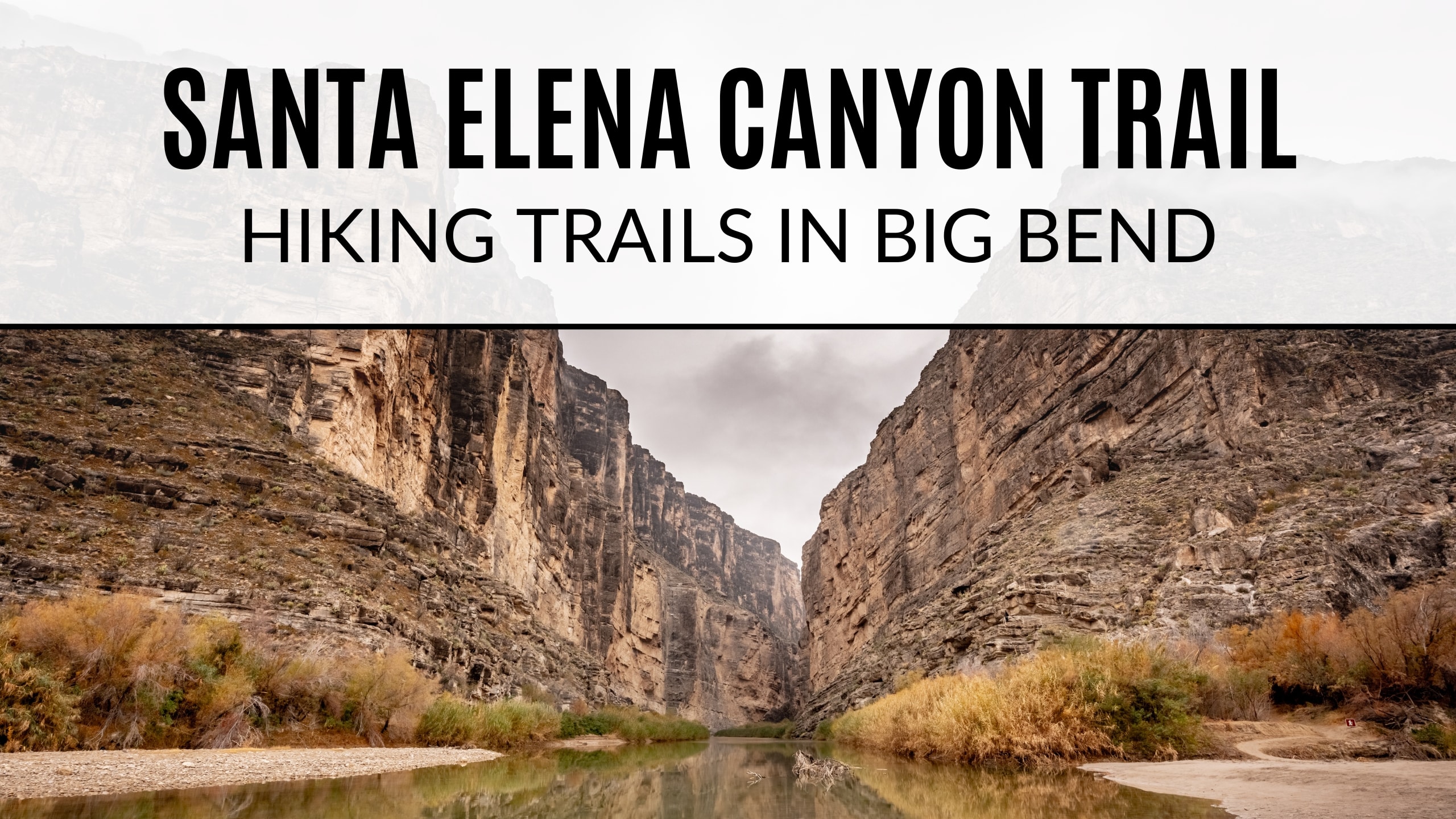
Santa Elena Canyon Overlook Trail Big Bend
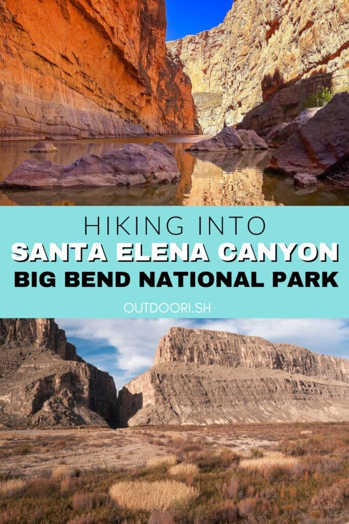
Santa Elena Canyon is one of the most iconic natural features in Big Bend National Park. It’s one thing you surely don’t want to miss if you pay Big Bend a visit! The canyon walls soar 1,500 feet above the Rio Grande making this a view visitors won’t soon forget.
Table of Contents
Santa Elena Canyon Overlook Trail Hiking Stats

Directions to Santa Elena Canyon Big Bend
Santa Elena Canyon is located on the Southwestern side of Big Bend National Park not far from the Castolon Historic District and Cottonwood Campground. There are two options to get to and from Santa Elena Canyon – Ross Maxwell Scenic Drive and Old Maverick Road.
Ross Maxwell Scenic Drive
Ross Maxwell Scenic Drive is a 30 mile scenic road that winds and snakes its way through the stunning landscape and the remains of former homesteads that were once active in the Big Bend region. Several trails start in the area including: Lower Burro Mesa Pouroff, Mule Ears, Tuff Canyon, Chimneys, and of course Santa Elena Canyon.

There are several spots along the way to pull over at overlooks and take it all in. The Mule Ears viewpoint gives you a chance to get out and stretch while providing a fantastic view of the Mule Ears – another iconic feature in Big Bend. The Sotol Vista overlook provides a stunning view of the western side of Big Bend. From here, you can see Santa Elena Canyon in the distance.

Along the scenic drive, you also have the opportunity to stop and check out the ruins of former ranches in the area. We pulled over at the Blue Creek Ranch Overlook and took the short trail down to what was once the Homer Wilson Ranch. Here you can explore a couple of the ranch buildings. Another pull off is the Sam Nail ranch. We did not stop at this one but it is another former homestead of this area. The remnants now provide shade and habitat for desert wildlife.

As you continue on the Ross Maxwell Scenic Drive, you’ll eventually come across the Castolon Historic District. This was formerly a cavalry camp. Today it serves as a visitor center and camp store. As you continue on, the scenic road comes to an end at Santa Elena Canyon. There is an overlook parking lot where you can view the canyon from a distance. If you drive a little farther, you will come across the trailhead parking lot.
Old Maverick Road
The second option to get to Santa Elena is taking Old Maverick Road. It is a 14-mile “improved dirt road” that passes along the Terlingua Creek badlands on the west side of the park. Be prepared! While most vehicles are able to use this road, it is extremely rough and washboarded. Although it’s half the length of Ross Maxwell Scenic drive, it still takes quite awhile (about an hour) to drive. We took this route on the way out of Big Bend from Santa Elena. We were finished in the park for the day and were headed back to the RV Park in Lajitas. Old Maverick Road meets up at Maverick Junction right near the booth where you pay to enter the park or show your park pass. It’s a good option to take if you’re leaving the national park for the day or if Santa Elena is your first stop of the day and you’re coming from outside the park.

Santa Elena Canyon Trailhead
As mentioned above, there are two parking lots. The first is an overlook of the canyon and has a nice place to take it in from a little bit farther back. There is a picnic table or two under a shelter, which would be a great place to enjoy lunch or a snack before/after your hike.
The second parking lot is the one you’ll want to reach the Santa Elena Canyon trailhead. Keep in mind this is an extremely popular trail! We’ve not had an issue finding parking here (we’ve been in the morning and later in the afternoon) but keep in mind it might be busier during peak seasons, especially when the spring break crowd is there. A couple restrooms are available in the middle of the parking lot. From there you’ll see a sign for the Santa Elena Canyon Trail along with some information about the hike. A little wooden board walk leads the way to the river.

Hiking Santa Elena Canyon Overlook Trail
This hike is short and sweet and a fantastic way to experience the Rio Grande up close. The trail starts by following a sandy/dirt path which leads down to the Rio Grande and where you’ll get the first glimpse of the canyon mouth up close. This area is where many outfitters launch river trips. A lot of these trips are multiple days. As much as we would have loved to go, it just didn’t work out this time. Canoeing through the canyon is on my bucket list and would be an incredible way to see the canyon and go even further than what the trail allows.

The trail continues off to the right. You’ll cross over Terlingua Creek and begin to climb a set of steep paved steps. (It’s important to note that Terlingua Creek sometimes floods and the trail becomes impassable at this point). Don’t let the stairs and switchbacks at the beginning of this trail intimidate you! After these first couple short switchbacks, the trail descends and follows the banks of the Rio Grande.

I loved all the lush vegetation and cliffs of limestone that towered above as we followed the path down the river. Again, I was getting all the Jurassic Park vibes and felt like I was on set in a movie. Eventually, the trail dead ends where the canyon walls meet the river.

There are several large boulders to take a rest on to enjoy looking down the canyon. You can’t visit the canyon without at least dipping a toe in the river. Many people like to cross the river and touch Mexico on the other side! When you’re ready to return you’ll follow the same route out that you took in since this is an out and back trail.

Although it is quite a drive to get to Santa Elena, your trip would not be complete without stopping here!
Happy Hiking!
More Big Bend Information
- Guide to Hiking the South Rim
- Hiking Lost Mine Trail
- Hiking to Balanced Rock
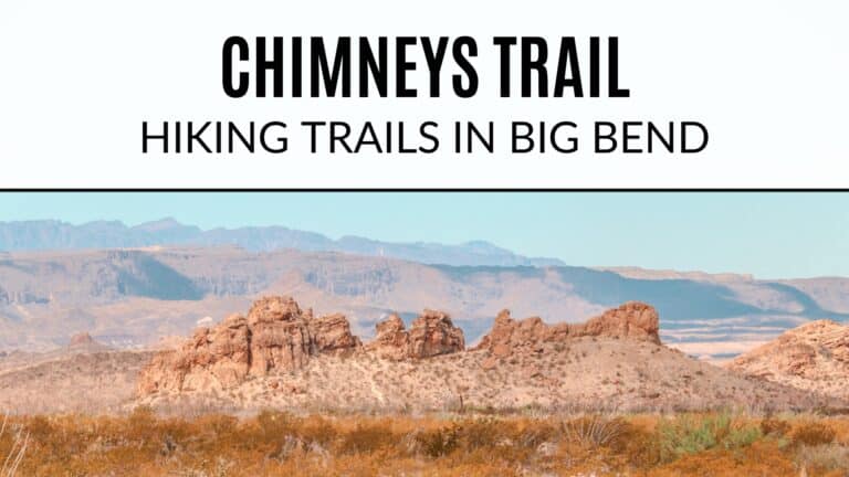
- Chimneys Trail
- Best Places to Camp In (and near) Big Bend
- Kayaking the Rio Grande
Big Bend NPS Information
- Desert Hikes
- Mountain Hikes
- River Hikes
- Backpacking
- Ross Maxwell Scenic Drive
- River Use Regulations
- Improved Dirt Roads in Big Bend

Wow – thank you some much for all the valuable info on Big Bend! I can’t believe how many amazing experiences there are to be had in this park.
I can’t believe we missed this one! Your pictures are gorgeous! 😍
Thank you!! The size is just jaw dropping when you see it in person. We had fun spotting it from a distance in other areas of the park too!!
Megan I seriously loved reading this and cannot wait to visit the area myself!
I know y’all would love it! You gotta get out there sometime, it’s definitely worth it 🙌🏼
Seriously, saving all of your Big Bend guides as we will visit in the Fall! Such great information!
Yay!! That’s so exciting! We’ve not been in fall yet but fall and spring are peak seasons so I’m sure it’ll be awesome. Can’t wait for you to experience Big Bend 😆
The views are beautiful! This was a great guide, with a lot of great information. Adding it to our bucket list
I’m sure your kids would enjoy this one too!
Seriously this place is just insane!! First, the names always crack me up😅 second, those VIEWS ARE INSANELY GORGEOUS and 3 I would’ve never guessed there were so many things here. Like water views, rock walls, that awesome mule ears area and I love that you can drive through it! Just a cool ass place 😍
We’ve been here also and loved it!! You summed it up perfectly!!! Love this, Megan! Miss it and want to go back!