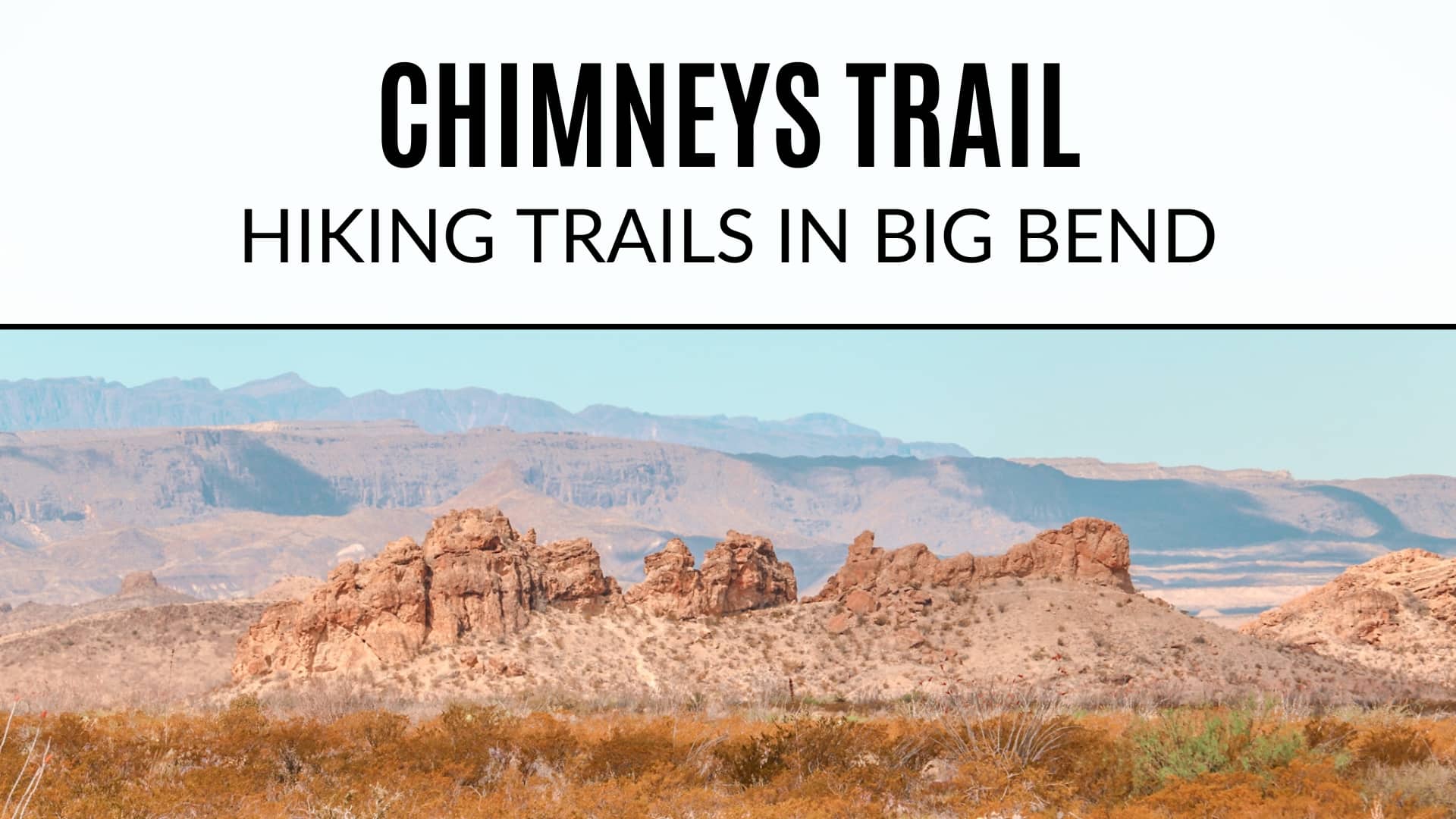
Chimneys Trail Big Bend
Big Bend National Park offers a variety of landscapes to hike. Mountains, rivers, and even desert hikes are abundant here. While it’s easy to get caught up in the stunning vistas the mountains provide or the canyons that can be seen from miles away, many of the desert hikes get easily over looked. To get the full Big Bend experience, I truly believe you need to do at least one mountain, river and desert hike. Each one offers a unique landscape to experience, different plant and animal life and views of the parks from different perspectives.
The Chimneys Trail in Big Bend is a moderate hike out to the “chimneys” which are a series of volcanic dike formations. The Chimneys served as an important point of reference for the Indians that lived in the area. Indian rock art marks the base of these pinnacles and is preserved as a reminder of how important this landmark once was.
Chimneys Trail Hiking Stats

How to Get to the Chimneys Trail Big Bend
The Chimneys Trail starts around mile 13 of the Ross Maxwell Scenic Drive there is a small parking lot off to the side of the road where you’ll also find information about the trail.

If you’re not familiar, Ross Maxwell Scenic Drive is a 30 mile long road that winds itself all the way to Santa Elena Canyon. There are many scenic overlooks and places to stop along the drive. There are also several trailheads along the route including: Lower Burro Mesa Pouroff, Mule Ears, Tuff Canyon, Chimneys, and of course Santa Elena. The Chimneys trailhead is located about halfway at mile marker 13.

Hiking the Chimneys Trail Big Bend
While this is one of the easier trails in Big Bend, there is absolutely no shade on the trail and it can get hot especially during the summer months. Plan to go early in the morning and bring plenty of water, sunscreen and a hat. I suggest wearing the big floppy hats that provide nice coverage and typically cover your neck too! I wore sunscreen and a hat and still managed to get sunburned.

The trail is mostly flat and at times feels like a scene from a movie where you’ve been walking and walking in the desert for ages with what feels like no end in sight. Okay, that might be a bit dramatic, but what I’m trying to say is that it’s not the most exciting or thrilling hike out there. About 2.4 miles into the hike you’ll come to the Chimneys which are a series of volcanic outcroppings.

Once you reach the Chimneys, the trail will split off into several directions. You can follow the path up the hill to the right for some fantastic views facing southwest towards Santa Elena Canyon. There is a small arch along the backside of the hill that you can climb through!

Off to the left there’s a chimney that stands by itself away from the group of chimneys on the right. This chimney is where we spotted several petroglyphs.

Once you’re done exploring the chimneys, you can choose to return back the way you came or follow the trail as it continues west for another 4.6 miles. We chose to return back the way we came since we only had one vehicle. If you do this, you’ll finish around 4.8 – 5 miles total. If you’re able to arrange having a vehicle at the end of the trail you may wish to continue on putting your mileage around 7 miles. The trail ends at Old Maverick Road near Luna’s Jacal.

I wouldn’t say this was our favorite hike or even one that is a “must do” but if you’re into history and want to see the petroglyphs it’s definitely worth doing. Plus, climbing around the chimneys is pretty fun too!
Happy Hiking!
More Big Bend Information
- Guide to Hiking the South Rim
- Hiking Lost Mine Trail
- Hiking Santa Elena Canyon
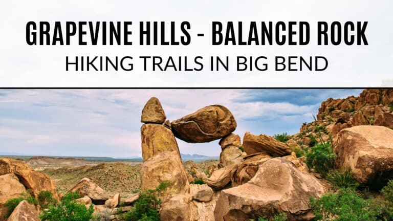
- Hiking to Balanced Rock
- Best Places to Camp In (and near) Big Bend
- Kayaking the Rio Grande
Big Bend NPS Information


I love all your hiking posts! This looks like another great place to go hiking. As always, you give the best info!
This looks like a fantastic place to hike! Thanks for all the tips! I love wearing big floppy hats to protect from the sun. Great suggestion!
It is an absolute must when there is no shade! I don’t care how silly I look in it haha 🤪
Thanks Chelsea!!
You have OFFICIALLY given me the hiking bug!!🥰🥰🥰
I can’t wait to explore these places. Thanks so much for all of the helpful information!
Ahh I can’t wait either! I know you’ll have a blast!
Yay, Big Bend! I just love having all the info at my fingertips 🙂 Nice that this hike is a little different than the others you’ve written about – the desert needs love too!
Yes!! I think you need to do at least one desert, one mountain and one river hiking when visiting here. Each one has something unique and special to offer 😄
This looks like such a beautiful hike, I’m sad we missed it! Next time we’ll have to make sure we get to do it 🙂
It was a fun one! I was sunburnt by the end though… oops!
Love me some petroglyphs! I wish I would’ve researched more about what we were actually looking at when we were in the desert! I knew it was an ocean that dried up but some of the stuff we saw we were just amazed at how they formed! You talking about the volcanic formations makes me curious!